
Back to Guide
Rishikesh to Kedarnath Distance Guide 2026
HARSHIT JAISWALSeptember 13, 2026 5 min read
The Rishikesh to Kedarnath distance is about 220 km by road plus a 16 km trek from Gaurikund. The Haridwar to Kedarnath distance is about 240 km by road plus the same 16 km trek. The Haridwar to Badrinath distance is about 320 km by road. Plan around 9-10 hours on the road to the Kedarnath base, 10-12 hours to Badrinath, and a full walking day for the final Kedarnath approach.
What the Kedarnath distance really means
The phrase “Rishikesh to Kedarnath distance” can sound like a single drive. It is not. The vehicle journey follows the Alaknanda and Mandakini valleys through Devprayag, Srinagar, Rudraprayag, Guptkashi, Sonprayag and Gaurikund.
From Gaurikund, the temple is approached by a roughly 16 km trek that can take six to eight hours on foot; pony and palki services are available in the area.
That difference changes how you plan. A car can reach the approach area, but it cannot take you to Kedarnath temple. A helicopter journey can reduce the walking requirement when operations, weather, passenger rules and availability allow, but it does not remove the need for an organised mountain itinerary. A Kedarnath helicopter plan still needs a road transfer, a reporting window and a backup approach if flying is interrupted.
The safest way to read the numbers is simple: road distance gets you to the operating base; route management gets you to darshan.
Rishikesh to Kedarnath route stage by stage
The route from Rishikesh is a gradual change of landscape rather than one long, featureless drive:
Rishikesh -> Devprayag -> Srinagar -> Rudraprayag -> Guptkashi -> Sonprayag -> Gaurikund -> Kedarnath
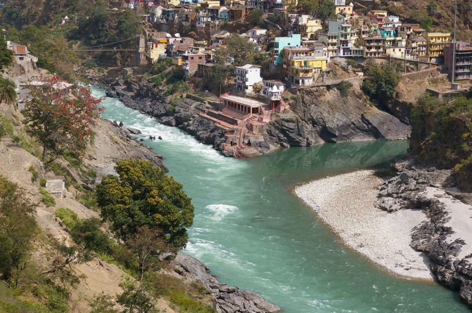
Rishikesh is a useful place for breakfast, vehicle checks, essential shopping and a last comfortable rest before the mountain road. Devprayag introduces the dramatic river geography, where the Bhagirathi and Alaknanda meet. Srinagar can support a practical meal or fuel stop when the route plan allows it.
At Rudraprayag, the route turns toward the Mandakini valley. Guptkashi matters because many Kedarnath stays, transfers and helicopter sectors are planned around this side of the valley. Sonprayag is the approach area for the final road movement, while Gaurikund is the traditional trek starting point.
If the trip includes a Kedarnath helicopter, ask where the flight sector begins, how the transfer reaches that helipad, what reporting time applies, what baggage is permitted and what happens if weather delays operations. These details matter more than a headline fare.
Haridwar to Kedarnath distance and departure strategy
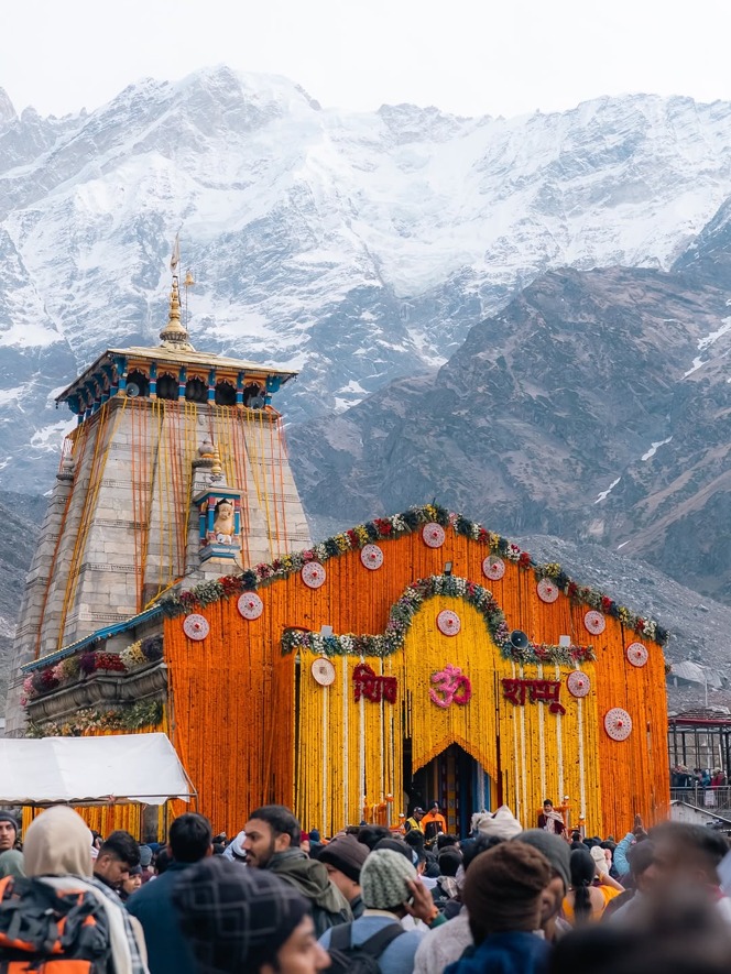
The Haridwar to Kedarnath distance is approximately 240 km by road plus the 16 km trek. Haridwar adds a shorter plains-side start, but the journey still joins the same Garhwal route through Rishikesh and Devprayag. In practical terms, the difference between starting in Haridwar and starting in Rishikesh is less important than the time you protect for the mountain section.
A comfortable plan avoids treating the road transfer, the trek and the return as one compressed event. Reach the planned base or overnight stop first, then begin the trek or helicopter sector after the group has eaten, hydrated, checked documents and understood the reporting instructions. Older travellers, children and anyone unused to altitude need recovery time built into the itinerary.
The road is part of the experience, with rivers, bridges, valley settlements and changing mountain light. It is also a working mountain corridor, so leave room for a slow section or weather-related change.
Haridwar to Badrinath distance and the second Chardham branch
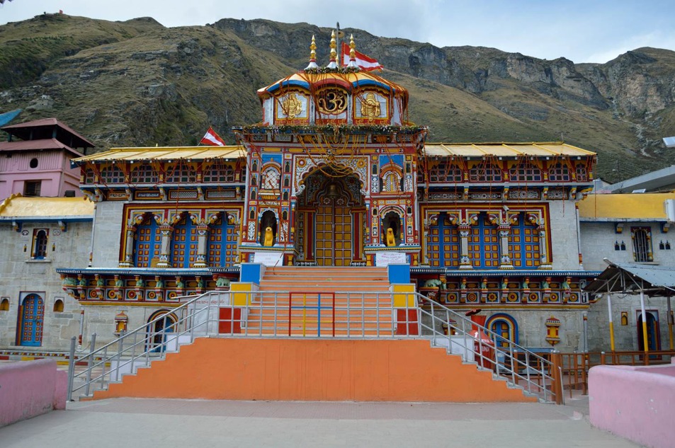
The Haridwar to Badrinath distance is approximately 320 km by road, with an estimated 10-12 hours of travel in normal conditions. The route runs through Devprayag, Srinagar, Rudraprayag, Karnaprayag, Nandaprayag, Joshimath and onward to Badrinath.
Unlike Kedarnath, Badrinath is approached by road to the temple town. That does not make it a quick add-on: the drive is long and altitude changes sharply. Joshimath can become an important staging point, while Mana Village is a possible extension when local conditions and time allow.
This is why travellers compare distances while planning a complete Chardham package. The route is a sequence of plains arrival, river confluences, mountain transfer, Kedarnath access, recovery and Badrinath road movement. The right number of nights depends on the group, not a generic “fastest” itinerary.
Stops and activities that make the route feel complete
The journey becomes more memorable when each stop has a purpose rather than becoming a rushed photo break.
Rishikesh: begin with the Ganga, bridge views, a calm breakfast and final packing rather than a late departure.
Devprayag: pause for the confluence and the town’s river-valley setting. Keep the stop short if the road schedule is tight.
Rudraprayag: use the confluence landscape as a visual pause before the route turns higher.
Guptkashi: review the next morning’s transfer, helipad or trek plan and keep essential items accessible.
Sonprayag and Gaurikund: follow local movement instructions, protect the group’s energy and avoid carrying unnecessary luggage.
Badrinath and Mana: allow time for temple visit, local walking and altitude-aware rest.
The best activity is the one that fits the route. Rafting, long walks, village visits and extra viewpoints belong only when season, local permissions, daylight and group ability make them sensible.
Road, trek or Kedarnath helicopter: who should choose what?
Choose the road-and-trek format when the group wants the full approach, has the physical capacity for a long high-altitude walk and can give the yatra enough time. Choose a helicopter-supported plan when reducing the walking load is important, when the group needs a more compact approach or when a tailored mobility plan makes it appropriate. A helicopter is a transport choice, not a guarantee against weather or operational disruption.
For a first-time Chardham traveller, the most useful question is not “Which route is cheapest?” It is “Which movement pattern can this group complete safely and calmly?” A tailored plan can combine road transfers, a Kedarnath helicopter sector, suitable stays, Badrinath sequencing and contingency time. Final fares, availability, flight sectors and operating rules must be confirmed for the selected travel date.
Turn distance into a workable mountain itinerary
Distances are the starting point, not the complete plan.
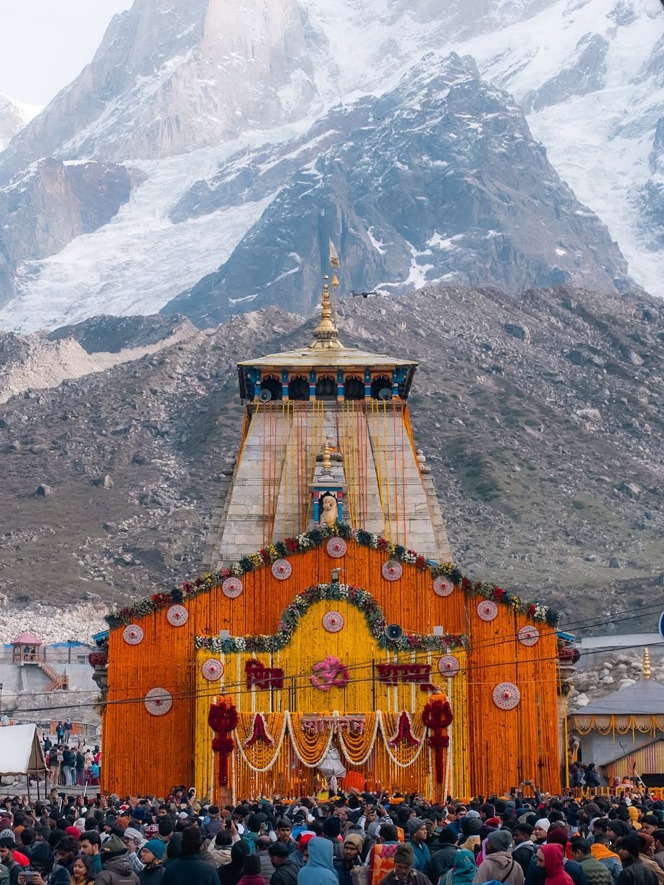
LN Tourism can help shape the road transfers, stays, Kedarnath helicopter coordination, trek or mobility choice and wider Chardham sequence around your dates and group.
Explore the Kedarnath Yatra from Haridwar package or
the Char Dham Yatra from Haridwar and Dehradun package.
For a tailored route discussion, call +91 88588-73018 or message LN Tourism on WhatsApp.

